|

Rigid division between water and land becomes transient when boundary is temporary. The unitary urbanism acknowledges flexible shifting borders; and celebrates edgeless living by exerting ice potentials. Challenging the limitations of coastal permanent soft infrastructure, the thesis imagines an autonomous interaction between people, architecture and the extreme changing environment.
 WHAT? WHAT?
The thesis envisions the feasibility of aquatic boundary urbanization among Arctic communities between Nunavut , Canada and Greenland[01]. It explores urban soft infrastructures which see seasonal sea ice[02] and icebergs[03] as commodities to offer raw fresh water resources and expansive surface. Today, the unique dynamic territory has been undergoing drastic transformation because of extreme climatic, social and economic variations. Under food insecurity and growing tourism, the project proposes urban infrastructures for hydroponic farming and tourist accommodation by utilizing ice resources from the ever-changing coasts. The resilient urban typology, which may stretch to a 3km-long coast, is designed to be adapted in and connected with various coastal cities within the extreme territory [04].
Situating in between freeze and thew, proximity and inaccessibility, dark and light, the contradicting site characteristics open up massive imagination on responsive and sustainable future urban design. The thesis challenges rigid separation of our urban milieu through mapping the fixed and dynamics of seasonal environmental changes and respective activities. Architectural dynamics happen in between land and water, mobile transport and floating collectives. It offers local residents and tourists a responsive yet resilient solution on living and food inadequacy in an unitary urbanism. It embraces the permeation of substantial transient programmes in soft coastal infrastructures, which acknowledges and creates temporary shifting boundaries. The organic design is adapted to imagine an autonomous

WHY?
Famous examples of aquatic boundary urbanism were visioned in metabolism movement in 1960s, such as the linear projection of city in Tokyo Bay by Kenzo Tange[01], the floating metropolis with cylindrical towers in Marine City by Kiyonori Kikutake and tetrahedral complex in Triton City by Buckminister Fuller. These massive utopia proposals encouraged organic growths through modular alternative living typologies. They focus self-sustainability processed through stationary mega infrastructures, which regrettably isolate themselves to the shores.
Today, floating urban proposals are gradually realized by visionary Dutch architects such as Koen Olthuis, who directed Waterstudio.NL, and Anne Loes Nillesen[02]. While we face urban congestion and climate change, architects contribute on problem-solving sustainable strategies on coastal urbanism. Palisade Bay, the backstory project that led to MoMA Rising Currents exhibition is one of the examples[03]. Designing through analytical and data mapping, soft infrastructures and urban communal relationship are explored to offer a foreseeable development.
Historic masterpieces in the discipline although may celebrate sustainability, hierarchic megastructure overwhelms dynamics of boundary interactions. Transforming contemporary aquatic urbanization, the thesis challenges the limitations of soft infrastructures through utilizing massive resources from the ocean[04]. It maps temporaries on autonomous happenings in extreme landscape and environment over days, seasons and decades, and innovates an adaptive volume from the water surface. As such, boundary is no longer permanent but dissolves various activities to create a new blurring coastal tempor(boundary).
HOW?
Step01 – First Thesis Review:
Intensive mapping of seasonal physical changes and respective activities in the territory over the course of time [01] /Sustainable ice harvesting and hydroponic farming systems responsive to the site [02]
Step02 – Second Thesis Review:
Proposal on autonomous urban process of food supply and living with their temporary coastal relation to site/ 1:1000~2000 Master plan[03] and massing model
Step03 – Third Thesis Review:
Design on soft infrastructures to support self sustaining farming activities, and provide interaction with flexible ephemeral spaces in different seasonal conditions/ 1:200~500 Plans, sections and axonometric drawings[04] and studying models
Step04 – Final Review:
Refine and test on final areas in mentioned drawings and models in details
Bibliography
1Theory: Tange, Kenzo. Tokyo Bay. 1960. Tokyo, Japan. Unbuilt.
Banham, Reyner. Megastructure: Urban Futures of the Recent Past. New York: Harper and Row, 1976.
Olthuis, Koen & Keuning David. Float!. Amsterdam: Frame Publisher. 2010.
Mayer, Jurgen & Bhatia Neeraj. -arium : Weather + Architecture. Ostfildern : Hatje Cantz, 2010.
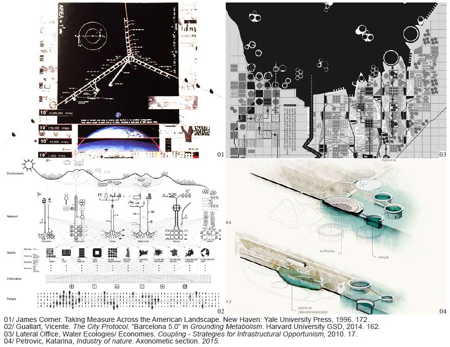
2Techniques: James Corner. Taking Measure Across the American Landscape. New Haven: Yale University Press, 1996.
Solomon, Jonathon & Wang, Clara. Cities Without Ground: A Hong Kong Guidebook. Hong Kong: Oro Editions, 2012.
Simpson, Deane. Young-Old. Zurich: Lars Muller Publishers, 2015.
Ibañez, Daniel & Katsikis Nikos. Grounding Metabolism, Cambridge: Harvard University GSD, 2014.
3 Projects: Infranet Lab & Lateral Office. Strategies for Infrastructural Opportunism. New York: Princeton Architectural Press, 2011.
Lau, Anthony. Floating City 2030: Thames Estuary Aquatic Urbanism. 2010. Thesis project.
Loes Nillesen, Anne & Singelenberg Jeroen. Amphibious Housing in the Netherlands. Rotterdam: NAi Publisher, 2011.
Guy Nordenson & Catherine Seavitt & Adam Yarinsky. On the Water: Palisade Bay. New York: MoMA, 2010.
|