|
|
1 THESIS ABSTRACT
The thesis will explore further capacity of the urban topography and multi-level urban configurations to enable district-crossing bicycle movement as a spatial typology injected into built urban areas.
The hilly hinderland of Kowloon Peninsula is outside the catchment coverage by MTR for pedestrians but potentially within the coverage by bicycles, as long as a new type of connection hub allows bicycles to be efficiently engaged as a new option constituting mixed-mode mass transport. The new typology shall take part in the discussion on how urban utility cycling in Metro Areas in Hong Kong can be re-admitted and re-encouraged in future transport development and planning, seizing the trend of urban redevelopment, brownfield site utilization, and potential revision in building codes.
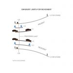
Gradient limits illustration for ascending and descending pedestrians, bicycles and vehicles
2 WHAT
Knowledge and order on lands in relation to bicycles can be consolidated as an idea of “cycle space”, like how “airspace” was defined. [1] Yet its differentiation from other “spaces” is ambiguous. There are occasions in urban planning when bicycle infrastructure became part of the pedestrianization movement, but there are cases cyclists have to dismount, being subsidiary to pedestrians. [2] Cycling is strictly forbidden in footpaths in Hong Kong under the old law. [3] Having wheels, cyclists share the roads with vehicles in many cities, and are bound to traffic laws and prone to dangers due to speed difference, making themselves also subsidiary to vehicles.
Since the late 20th century, cycle space had been dedicated to separated cycleways and facilities in cities through new town development, urban design and segregation in pedestrianized spaces, conversions from highways, redevelopment of brownfield sites and abandoned railways, as well as excavations. [4 5 6 7 8] As it tends to reduce vehicular traffic, it is widely advocated and standardized as a green transportation, [9] yet its infrastructural meaning as discourse had not been prioritized until the term “Cycle Superhighway” was introduced as strategic bicycle routes serving the Greater London, Greater Copenhagen and intercity links in Germany and Netherlands. [10]
The thesis will investigate how the aforesaid idea and system can be applied into the built urban realm of Hong Kong by enhancing the “tunnel-bridge compound” typology and the “groundless” spatial concept which already exists in Hong Kong. [11]
Adam Frampton, Clara Wong, and Jonathan Solomon, Cities without Ground: A Hong Kong Guidebook (Rafael, CA: Oro Editions, 2012). 108.
Digital photo. Accessed December 14, 2016. http://www.fhshh.com/upload/1/a5/1a5e93375b83c095.png.
CycloCable in Trondheim, Norway, currently the only cyclist escalating system in the world.
3. WHY
Despite a “cyclehighway” system connecting new towns currently under construction in Hong Kong, the authority still refrains from encouraging cycling through built Metro Areas, where half of Hong Kong population is housed, for reasons concerning laws, topography, traffic and complement by existing public transport systems. [12] The thesis will tackle the physical constraints and explore exceptions.
There had been an urge to reconsider a holistic bicycle policy in Hong Kong, which can be assisted by new infrastructure. Bike connections and parking facilities are being stipulated in the scoring criteria in LEED requirements on buildings in the US, [13] which would be spread to Hong Kong when globalized. Besides, “Hong Kong 2030+” planning studies target to address the growing number of buildings reaching their structural life-span and pending redevelopment. [14] The two issues would be interlinked in future urban transformations.
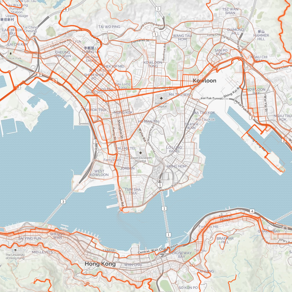
Outside the pedestrian catchment area 500m away from MTR stations, the hinderland of Kowloon Peninsula is selected as the study area. It is the remaining void to similar projects in the Metro Areas, such as “Harbourfront Cycleway” on Hong Kong Island, and the proposed networks and facilities in Tsuen Wan and Kai Tak which had been pioneers as they are commonly on reclaimed land for easier implementation. [15 16 17 18 19 20 21 22] The existing slopes, brownfield sites and open spaces are the most readily available spaces for the execution.

BikeMaps. Accessed September 22, 2016. https://bikemaps.org/@22.3124829,114.1888046,14z.
Traces of Bike Movement in Kowloon Peninsula
4. HOW
Research and Mapping
- Mapping of site potentials and problem identification
- Land use distribution and demographics
- Existing public transport network
- Cyclists behavior, spatial interaction and constraints
For the site context, existing infrastructure, hurdles and spaces will be the key subject of study. The urban qualities of the areas indeed remain certain potential to establish bicycle linkages, joining the missing links. There are some geographical features for further study:
-
Slopes where continuous contour lines can be found;
-
Sloped ways allowing effortless descent, and possibly requiring aided ascent;
-
Air and underground spaces sandwiching railways and highways, some of which already occupied as numerous caves and podiums;
-
Existing open spaces scattered on the hills;
- Commuting population uphill providing demand;
-
MTR stations within 5 minutes away if direct cycling is possible; and
-
Dense cyclists’ movement along gently sloped and straight but busy roads, as logged in BikeMaps. [23]
Design
- Site and route selection
- Design strategy, parameters and necessary programs
- Massing studies and evaluation
- Construction design
Dependent upon the result of mapping, the site would be one section of the proposed network, and a prototype which can demonstrate the whole system. Such space shall primarily work as connector, and secondly a cluster of auxiliary facilities, creating a new place to the public to achieve further metaphysical meanings.
Parameters over design strategy include integration to terrains, slopes, safety against vehicular traffic, convenience to cyclists and pedestrians and integration to built or new spaces. Proximity to public transport access including MTR and bus terminals would be a factor to enhance transit-oriented development strategy of Hong Kong.
Http://cycle-space.com/author/steven/. “Green Maps.” |. 2016. Accessed November 07, 2016. http://cycle-space.com/green-map/.
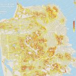
“Streets Colored by Slope in San Francisco, CA, USA.” Map. The Steeps Of San Francisco In Search Of The City’s Steepest Street. November 10, 2009. Accessed September 22, 2016. http://www.datapointed.net/media/2010/08/sf_slope_big.jpg.
NOTES
-
Fleming, Cycle Space : Architecture & Urban Design in the Age of the Bicycle, 7-8.
- @BicycleDutch, “Car Free City Centre in Utrecht,” BICYCLE DUTCH, 2016, , accessed December 14, 2016, https://bicycledutch.wordpress.com/2014/11/06/car-free-city-centre-in-utrecht/.
-
“Laws and Regulations 法律及條例 | Hong Kong Cycling Alliance 香港單車同盟.” Hong Kong Cycling Alliance. Accessed November 07, 2016. http://hkcyclingalliance.org/laws-and-regs
-
“Main Content,” Cycle Track Network – Extension, , accessed December 14, 2016, http://www.td.gov.hk/mini_site/cic/en/active-projects-studies/projects/major-projects.html.
The ongoing new town cycle track development in Hong Kong.
-
London Cycling Design Standards. London: Published by Transport for London, 2014. Accessed November 7, 2016. http://content.tfl.gov.uk/lcds-chapter1-designrequirements.pdf.
Study and implementation on further categorization of cycle spaces in London.
-
“WORK,” MONK MACKENZIE., , accessed December 14, 2016, http://www.monkmackenzie.com/index/.
Nelson Street Cycleway, Auckland designed by Monk Mackenzie, NZIA, RIBA.
-
“Trails // Atlanta BeltLine,” Atlanta BeltLine Trails, accessed December 14, 2016, https://beltline.org/visit/trails/.
Atlanta BeltLine, Atlanta.
-
“ECO Cycle,” GIKEN LTD, , accessed December 14, 2016, https://www.giken.com/en/solutions/underground_developments/eco_cycle/
Privatized underground cycle parking machine in Japan.
- “LEED ND: Plan | v4 – LEED v4 – Bicycle facilities”. Accessed November 07, 2016. http://www.usgbc.org/credits/neighborhood-development-plan-neighborhood-development/v4-draft/sllc4
- Https://facebook.com/transportforlondon. “Cycle Superhighways.” Transport for London. Accessed November 17, 2016. https://tfl.gov.uk/modes/cycling/routes-and-maps/cycle-superhighways.
-
Adam Frampton, Clara Wong, and Jonathan Solomon, Cities without Ground: A Hong Kong Guidebook (Rafael, CA: Oro Editions, 2012).
-
Cycling Study. Report. Transport Department, HKSAR. April 2004. Accessed November 11, 2016. http://www.td.gov.hk/filemanager/en/publication/cyclingstudy.pdf.
Contract No. TD 100/2002
- “LEED ND: Plan | v4 – LEED v4 – Bicycle facilities”. Accessed November 07, 2016. http://www.usgbc.org/credits/neighborhood-development-plan-neighborhood-development/v4-draft/sllc4
- “Hong Kong 2030 Plus.” Accessed November 17, 2016. http://www.hk2030plus.hk/
- “The Hong Kong Harbourfront Cycleway.” The Hong Kong Harbourfront Cycleway. 2013. Accessed November 07, 2016. http://harbourfrontcycleway.hk/.
- “Urban Design Study.” Urban Design Study. Accessed November 17, 2016. http://www.pland.gov.hk/pland_en/p_study/comp_s/UDS/eng_v1/uds_eng.htm.
-
Urban Design Study for the New Central Harbourfront. Information Digest. Planning Department, HKSAR. Jul 2011. Accessed November 17, 2016. http://www.pland.gov.hk/pland_en/p_study/comp_s/UDS/eng_v1/images_eng/pdf_paper/info_digest.pdf.
-
Urban Design Study for the New Central Harbourfront. Master Layout Plan. Planning Department, HKSAR. Feb 2011. Accessed November 17, 2016. http://www.pland.gov.hk/pland_en/p_study/comp_s/UDS/eng_v1/images_eng/pdf_paper/mlp_16feb11.pdf
-
Stage 2 Public Engagement Exercise, Urban Design Study for the Wan Chai North and North Point Harbourfront Areas. Engagement Digest. Planning Department, HKSAR. June 2016. Accessed November 11, 2016. 29. http://www.wcnnpuds.hk/web/pdf/WCNNPUDS_PE2_Digest_20160611.pdf.
- “Boardwalk Underneath Island Eastern Corridor.” Boardwalk Underneath Island Eastern Corridor. Accessed November 07, 2016. http://www.boardwalk.gov.hk/en/index.html.
-
“Document No. 23/2011.” Accessed November 17, 2016. http://www.districtcouncils.gov.hk/archive/kt_d/pdf/crsc/2011/CRSC paper 23_2011.pdf.
Kwun Tong District Council Discussion Paper
- “On-going Projects.” CEDD – Cycle Track between Tsuen Wan and Tuen Mun. Accessed November 17, 2016. http://www.cedd.gov.hk/eng/projects/major/ntw/nnw7268rs_b.html.
-
BikeMaps. Accessed September 22, 2016. https://bikemaps.org/@22.3124829,114.1888046,14z.
GPS tracking of Bike Movement in Kowloon Peninsula.
BIBLIOGRAPHY
-
Fleming, Steven. Cycle Space : Architecture & Urban Design in the Age of the Bicycle. Rotterdam: Nai010 Publishers, 2012.
-
Frampton, Adam, Clara Wong, and Jonathan Solomon. Cities without Ground: A Hong Kong Guidebook. Rafael, CA: Oro Editions, 2012.
-
Allen, S. (1999). Infrastructural Urbanism. In On Landscape Urbanism. pp. 174- 181. Austin TX: Center for American Architecture and Design University of Texas at Austin School of Architecture.
-
Herlihy, David V. Bicycle: The History. New Haven: Yale University Press, 2004.
-
Gandy, Matthew. The Fabric of Space: Water, Modernity, and the Urban Imagination. Cambridge, MA: MIT Press, 2014.
-
Jacobs, Jane. The Death and Life of Great American Cities. New York: Random House, 1961.
-
Webster, Chris (2007). “Property rights, public space and urban design”, in Town Planning Review, Vol. 78, Issue 1, pp. 81‐101
-
Bendiks, Stefan. Fietsinfrastructuur: Stefan Bendiks = Cycle Infrastructure. Rotterdam: NAI Publ., 2013.
- Blyth, Gavin. Velo City: Architecture for Bikes. Munich: Prestel, 2014.
1 THESIS STATEMENTThe thesis will explore remaining capacity of the urban topography and multi-level urban configurations to interact, to enable district-crossing bike network across the built urban areas, particularly in Kowloon Peninsula in Hong Kong.The thesis will identify topographical and infrastructural hurdles obstructing bike circulation in the developed urban area, which contains opportunities for engagement instead of ignorance. Such engagement shall involve spatial injection to re-route and introduce bike traffic and bike activities without diminishing resource-distribution volume and capacity of existing channels for existing transport means and pedestrian movement, while such ignorance refers to official description and general impression over the impossibility for urban cycling in Hong Kong Metro Areas, which shall be doubted and evaluated.2 WHATThe project aims at proposing a place as well as a designed space to inject a new infrastructure for bikes across Kowloon Peninsula, with the aim to reconnect the urban fabric available to district-crossing cyclists to enhance bike-commuting culture in Hong Kong.Parameters over design strategy include the integration to hilly terrains, slopes, safety against vehicular traffic, convenience to cyclists and pedestrians, distance from public transport access including MTR and bus terminals, and the accessibility to existing land uses.Dependent upon the result of mapping, the site would be a place which is currently unfavorable to bikes, before the insertion of a new space. Such space shall primarily work as connector, and secondly a cluster of auxiliary facilities, creating a new place to the public.3. WHYBACKGROUNDDespite precedences of injection of bike infrastructure and policies pioneered in cities in Europe and the US, and followed all around the world, with the rationales and discourses behind such movements related to the post-industrial demand and New Urbanism concepts, [1-5] Hong Kong falls behind such trend regarding the improvement of cycling environment inside developed Metro Areas (Hong Kong Island, Kowloon and Tsuen Wan as defined by planning authorities). Even in new towns, the planning and civil engineering authorities have fairly negative attitudes towards urban cycling, as revealed by the inclusion of cycle track networks with auxiliary facilities solely for leisure purpose in every new town since the 1970s. [6] Only after responding to advocacy campaigns and growing needs for cycling as both leisure and commuting, some recent new urban development plans abutting the harbour in Metro Areas have planned to include cycle tracks. For the Hong Kong Island, the ‘Harbourfront Cycleway’ had been advocated by the public as the prime route connecting the Island, [7] and being considered and implemented by the government by stages, firstly along Central Waterfront, Wan Chai Waterfront and Boardwalk beneath the Island East Corridor. [8-10][11][12] On the opposite side of the harbour, the networks in Tsuen Wan and Kai Tak (including Kwun Tong) are under detailed design [13][14], leaving Kowloon Peninsula the remaining areas not yet discussed, except closed loops for bikes inside parks. [15]Bicycle / bike enlarges the sphere of pedestrian activity under the same magnitude of time, like shrinking a city into big building blocks. [16] As it tends to replace the use of vehicles, it is widely advocated and studied as a green urban transport promoting public health, yet its infrastructural meaning had not been placed at the top priority of discourse, until the term ‘Cycle Superhighway’ was introduced.Since the 21st century, some cities have identified several popular or strategic bike routes and upgrade or differentiate them into a category ‘highway for cycles’, physically promoting separation from traffic, higher speed and vivider identity to raise its readability and competitivity in the city, to serve metropolitan areas and suburbs such as Greater London, Greater Copenhagen and town clusters in Germany and Netherlands. [17] Hong Kong will have such system, with most new towns to be joined together by a long cycle track. [18-20] Yet the authority still refrains from encouraging the public to ride a bike through built Metro Area, where half of Hong Kong population is housed, for a bunch of reasons related to laws, topography, traffic and complement by existing public transport systems. [6]In many places like London, whether cycling is available on shared or segregated cycleways are reviewed and implemented under a new categorization logic. [21] Hong Kong lacks behind, maintaining the history that cycling on footpaths are legally prohibited, while such limitation does not apply to footbridges and pedestrian subways. Roads in Hong Kong are legally inclusive to bikes even though roads do not include foot-path, tunnels, highways and roads with designated cycle paths alongside. [22] Most roads become shared cycleway, where fatal traffic accidents sometimes occur in spots with heavy and uncontrolled vehicular traffic.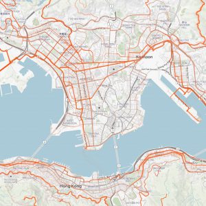
BikeMaps. Accessed September 22, 2016. https://bikemaps.org/@22.3124829,114.1888046,14z.
Traces of Bike Movement in Kowloon Peninsula 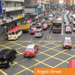
“Central Kowloon Route.” Central Kowloon Route. Accessed November 18, 2016. http://www.ckr-hyd.hk/en/about.php?page=2#!prettyPhoto/7/.
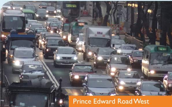
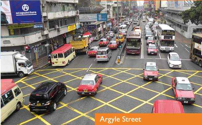
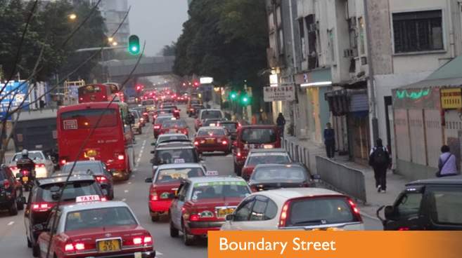
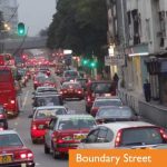
Capture of traffic congestions on popular bike routesSIGNIFICANCEBike connections and parking facilities are being stipulated in the scoring criteria in LEED requirements on buildings in the US. [23] When this demand becomes globalized, such requirement would be spread to BEAM in Hong Kong. As mentioned in ‘Hong Kong 2030+’ planning studies, there is a growing number of buildings reaching their structural life-span and pending redevelopment [24]. Thinking progressively, the two issues are interlinked, providing an urge to reconsider a complete bike ‘highway’ network to enable new commuting modes (mixed-mode or solely cycling) for the metro populations.It lacks cycle space studies or data in Hong Kong metro areas except BikeMaps, which only keeps tracking the cyclists’ movement with GPS. [25] Where popular bike paths and unpopular areas are identified, the incentives and threats behind such observations are yet to be explored, for the sake of further enhancement project.Situating in the middle of the city, the hinderland of Kowloon Peninsula is deemed to be blocking in the midway for inexperienced cyclists to pass through. (The refers to inland areas around Kowloon Tong, Kings Park, Ho Man Tin and Hung Hom) Nevertheless, the urban qualities of the areas indeed remain certain potential to provide bike linkages, joining the missing links. There are some geographical features:hillslopes where continuous contour lines can be found;hillslopes allow effortless downslope movement, and would require aided upslope movement;there are air and underground spaces sandwiching railways and highways, some are already occupied as numerous caves and podiums;there are typologies of tunnel-bridge compounds already working in Hong Kong;there is a huge commuting population uphill providing demand; andthere are MTR stations outside walking distance but only minutes away if cycling is possible, aiding mixed-mode commuting.It worths being skeptical towards the urban landscape described in the mainstream discourse, and study the possibility to utilize these urban features into new kind of infrastructure. With a quality spatial connection, rooms would be allowed for future handy modes of transport serving the same functions as bikes.See Case Studies [to be listed].“AAA Report – Section 2, Bicycle Users.” AAA Report – Section 2, Bicycle Users. Accessed November 11, 2016. http://truewheelers.org/research/studies/aaa/02users.htm.Taylor, Matthew, and Matthew Taylor. “City’s Two-wheel Transformation.” The Guardian. 2008. Accessed November 10, 2016. https://www.theguardian.com/uk/2008/feb/09/transport.world1.“London Cycling Campaign.” London Cycling Campaign. Accessed November 10, 2016. http://lcc.org.uk/pages/who-we-are.“History.” History – Alliance for Biking & Walking. Accessed November 11, 2016. http://www.bikewalkalliance.org/about/history.-
Cycling Study. Report. Transport Department, HKSAR. April 2004. Accessed November 11, 2016. http://www.td.gov.hk/filemanager/en/publication/cyclingstudy.pdf.
Contract No. TD 100/2002
“The Hong Kong Harbourfront Cycleway.” The Hong Kong Harbourfront Cycleway. 2013. Accessed November 07, 2016. http://harbourfrontcycleway.hk/.“Urban Design Study.” Urban Design Study. Accessed November 17, 2016. http://www.pland.gov.hk/pland_en/p_study/comp_s/UDS/eng_v1/uds_eng.htm.Urban Design Study for the New Central Harbourfront. Information Digest. Planning Department, HKSAR. Jul 2011. Accessed November 17, 2016. http://www.pland.gov.hk/pland_en/p_study/comp_s/UDS/eng_v1/images_eng/pdf_paper/info_digest.pdf.Urban Design Study for the New Central Harbourfront. Master Layout Plan. Planning Department, HKSAR. Feb 2011. Accessed November 17, 2016. http://www.pland.gov.hk/pland_en/p_study/comp_s/UDS/eng_v1/images_eng/pdf_paper/mlp_16feb11.pdfStage 2 Public Engagement Exercise, Urban Design Study for the Wan Chai North and North Point Harbourfront Areas. Engagement Digest. Planning Department, HKSAR. June 2016. Accessed November 11, 2016. 29. http://www.wcnnpuds.hk/web/pdf/WCNNPUDS_PE2_Digest_20160611.pdf.“Boardwalk Underneath Island Eastern Corridor.” Boardwalk Underneath Island Eastern Corridor. Accessed November 07, 2016. http://www.boardwalk.gov.hk/en/index.html.-
“Document No. 23/2011.” Accessed November 17, 2016. http://www.districtcouncils.gov.hk/archive/kt_d/pdf/crsc/2011/CRSC paper 23_2011.pdf.
Kwun Tong District Council Discussion Paper
“On-going Projects.” CEDD – Cycle Track between Tsuen Wan and Tuen Mun. Accessed November 17, 2016. http://www.cedd.gov.hk/eng/projects/major/ntw/nnw7268rs_b.html.-
Cycling Tracks/Ground. Accessed November 11, 2016. http://www.lcsd.gov.hk/en/facilities/facilitieslist/districts.php?ftid=17.
See the facilities on Kowloon and Hong Kong Island.
Fleming, Cycle Space : Architecture & Urban Design in the Age of the Bicycle, 7-8.Https://facebook.com/transportforlondon. “Cycle Superhighways.” Transport for London. Accessed November 17, 2016. https://tfl.gov.uk/modes/cycling/routes-and-maps/cycle-superhighways.“Cycle Tracks Connecting North West New Territories with North East New Territories – Tuen Mun to Sheung Shui Section (Remaining).” Accessed November 17, 2016. http://www.cedd.gov.hk/eng/projects/major/ntw/nnw7259rs_b.html.“Cycle Tracks Connecting North West New Territories with North East New Territories – Tuen Mun to Sheung Shui section (Stage 1).” Accessed November 17, 2016. http://www.cedd.gov.hk/eng/projects/major/ntw/nnw7279rs_a.html.“Cycle Tracks Connecting North West New Territories with North East New Territories – Sheung Shui to Ma On Shan section” Accessed November 17, 2016. http://www.cedd.gov.hk/eng/projects/major/ntw/nnw7271rs_a.html.London Cycling Design Standards. London: Published by Transport for London, 2014. Accessed November 7, 2016. http://content.tfl.gov.uk/lcds-chapter1-designrequirements.pdf.“Laws and Regulations 法律及條例 | Hong Kong Cycling Alliance 香港單車同盟.” Hong Kong Cycling Alliance. Accessed November 07, 2016. http://hkcyclingalliance.org/laws-and-regs.“LEED ND: Plan | v4 – LEED v4 – Bicycle facilities”. Accessed November 07, 2016. http://www.usgbc.org/credits/neighborhood-development-plan-neighborhood-development/v4-draft/sllc4“Hong Kong 2030 Plus.” Accessed November 17, 2016. http://www.hk2030plus.hk/.BikeMaps. Accessed September 22, 2016. https://bikemaps.org/@22.3124829,114.1888046,14z.
Traces of Bike Movement in Kowloon Peninsula4. HOWResearchMapping of hurdles to cycling in Kowloon Peninsula, using a number of physical and urban parametersIdentification of land use, hubs and population density in Kowloon PeninsulaIdentification of public transport networkIdentification of preferred primary route of the new bike network, and the key spot for the siteMapping of cyclists behavior and spatial implications-
Http://cycle-space.com/author/steven/. “Green Maps.” |. 2016. Accessed November 07, 2016. http://cycle-space.com/green-map/.
-
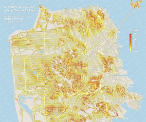
“Streets Colored by Slope in San Francisco, CA, USA.” Map. The Steeps Of San Francisco In Search Of The City’s Steepest Street. November 10, 2009. Accessed September 22, 2016. http://www.datapointed.net/media/2010/08/sf_slope_big.jpg.
DesignSetting of design strategy, necessary programs and design parametersLocating topographical and infrastructural contextMassing studies and evaluationDetailed design-
5. BIBLIOGRAPHYFleming, Steven. Cycle Space : Architecture & Urban Design in the Age of the Bicycle. Rotterdam: Nai010 Publishers, 2012.Herlihy, David V. Bicycle: The History. New Haven: Yale University Press, 2004.Corbusier, Le, and Frederick Etchells. Towards a New Architecture. London: Architectural Press, 1946.Gandy, Matthew. The Fabric of Space: Water, Modernity, and the Urban Imagination. Cambridge, MA: MIT Press, 2014.Jacobs, Jane. The Death and Life of Great American Cities. New York: Random House, 1961.Webster, Chris (2007), “Property rights, public space and urban design”, in Town Planning Review, Vol. 78, Issue 1, pp. 81‐101Bendiks, Stefan. Fietsinfrastructuur: Stefan Bendiks = Cycle Infrastructure. Rotterdam: NAI Publ., 2013.Blyth, Gavin. Velo City: Architecture for Bikes. Munich: Prestel, 2014.Corbusier, Le, Towards a New Architecture.6. PRECEDENTSHttp://cycle-space.com/author/steven/. “Green Maps.” |. 2016. Accessed November 07, 2016. http://cycle-space.com/green-map/.“Park Connector Network.” National Parks Board. Accessed November 07, 2016. https://www.nparks.gov.sg/gardens-parks-and-nature/park-connector-network.“Master Plan.” Transport. Accessed November 07, 2016. https://www.ura.gov.sg/uol/master-plan/View-Master-Plan/master-plan-2014/master-plan/Key-focuses/transport/Transport.“Streets Colored by Slope in San Francisco, CA, USA.” Map. The Steeps Of San Francisco In Search Of The City’s Steepest Street. November 10, 2009. Accessed September 22, 2016. http://www.datapointed.net/media/2010/08/sf_slope_big.jpg.“Cykelslangen.” DISSING WEITLING. Accessed November 07, 2016. http://www.dw.dk/cykelslangen/.“Hovenring.” Hovenring. Accessed November 07, 2016. https://hovenring.com/.Wainwright, Oliver. “Norman Foster Unveils Plans for Elevated ‘SkyCycle’ Bike Routes in London.” The Guardian. 2014. Accessed November 07, 2016. https://www.theguardian.com/artanddesign/architecture-design-blog/2014/jan/02/norman-foster-skycycle-elevated-bike-routes-london.“About the High Line | Friends of the High Line.” The High Line. Accessed November 07, 2016. http://www.thehighline.org/about/.Https://facebook.com/transportforlondon. “Cycling.” Transport for London. Accessed November 07, 2016. https://tfl.gov.uk/corporate/publications-and-reports/cycling.-
-
-
3. WHY[Updated 7 Nov 2016]Bike is a pedal-powered transportation tool which raises speed of circulation for efficiency and comfort, and enlarges the physical range of living in the community. Bike has been utilized for commuting and working purpose for more than a century, while streets as public space have been historical biking places. However, places experienced growing vehicular traffic and standardization of road system have encountered spatial and safety conflicts between vehicles and bikes, diminishing bike population. The developed world currently in the trend of reintroducing and encouraging bike commuting usually claims the benefits, including sustainability, public health, traffic congestion relief, and green lifestyle, as rationales behind such movement and urban transformation projects.Defining the roles of bike in urban planning and design is crucial. If bikes are considered as commuting tools, the whole city would respect cyclists. Nevertheless, Hong Kong Government has long defined cycling as leisure activity since the development of New Towns in 1970s, until 2016 when the cycling is still categorized as an activity but not connection means, as mentioned in the public consultation for the Wan Chai Waterfront Urban Design Study. With the same definition of cycling in the city, the bike networks could only be shattered and confined in small parks in Kowloon and Hong Kong Island.According to the advocates for the Harbourfront Cycleway since 2011, cycleway should not be meant to be only designated cycle tracks, but instead all kinds of continuous space where cycling is possible. In reality, roads in Hong Kong are legally inclusive to bikes even though roads do not include foot-path, tunnels, highways and roads with designated cycle paths alongside. Roads becomes shared cycleway, where fatal traffic accidents sometimes occur.There is a need for a complete system of cycleway particularly on Kowloon Peninsula to provide safe and convenient alternative routes for cyclists today, and encourage potential cross-district cyclists to enjoy the new infrastructure. A general aim of the thesis project is to insert new spaces or convert residue urban spaces into a bike hub, at a key spot or bottleneck spot to reconnect the network. As new programs are inserted into the site, the place character would be converted for the sake of cycling.-
[Updated 11 Nov 2016]Bicycle is a pedal-powered tool aiding human movement with a wider range of speed. It enlarges the sphere of urban living under the same magnitude of time, like shrinking a city into big building blocks. [1] Historically, mass bike transit in cities and towns was the result of the invention of ‘safety bicycle’ in 1889, which allowed both genders to ride. [2] Notable countries experiencing ‘Bicycle Craze’ included the USA in 1890s and Europe in 1970s, PRC before 1980s, and London in 2010s. There have been triggering issues behind such boom. For the 1970s, for instance, it was believed that the rising gas cost after 1973 oil crisis contributed in the public encouragement to bike commuting. [3] Government policies also contribute in adopting bike-related policies and putting forward bike infrastructure, like the Cycle Superhighways project, which was announced in 2008 by Ken Livingstone, Mayor of London, and being constructed on existing roads and urban spaces in the 2010s. [4]Streets as public cycle space have been historical biking places. However, places experienced growing car-ownership and vehicular traffic, as well as standardization of highway systems, have encountered spatial and safety conflicts between vehicles and bikes, discouraging bike commuting. [5] Following the bicycle boom undergoing in some developed regions, their governments and advocates that are promoting bike commuting in policy-making, urban planning and infrastructural projects usually claims the benefits, including economy, sustainability, public health, and traffic congestion relief. [4][6][7]Bikes shall be considered in the same weight as automobiles and other infrastructure in urbanism. Bikes have their characteristics in urban living which automobiles and other transport means cannot achieve, including direct control of movement, penetration in small spaces, easy riding, alighting and parking. Bikes can be seen as a symbol that late-capitalism is being resisted, which involved individualized way of use and making, as well as freedom in mobility. This makes what designers see bikes matching the way Le Corbusier saw automobiles as a paragon of engineering perfection, constituting as evidence of modernism. [8][9] Also, all spaces allocated to transportation (including cycle spaces) are regarded as a category of infrastructure, the definition of which was extended from the French term referring to railway-related construction in 1870s. [10] Infrastructure involved intensive applications of technology, showing its contribution in modernization, while infrastructure itself and its subsequent changes in efficient lifestyle represent modernity. [11] If automobiles are the symbol of industrial city, the post-industrial city shall be inclusive to bikes as an additional kind of transport means in a scientific and holistic way.We see that Netherlands has the highest bike modal share, as high as 50%, while other developed countries contain a rising using of bike in commuting. [5] However, Hong Kong falls behind. Provided that defining the roles of bike in urban planning and design is crucial, Hong Kong Government had long defined cycling as a leisure activity since the development of New Towns in 1970s, until now when the cycling is still categorized as an activity but not transport nor connection means, as mentioned in the public consultation for the Wan Chai Waterfront Urban Design Study. [12][13] With the same definition of cycling in the city, bike networks could only be shattered and confined in small parks as loops in Kowloon and Hong Kong Island. [14]The Harbourfront Cycleway was advocated on Hong Kong Island for 5 years as a pioneer of public initiative for injecting bike infrastructure into this city. [16] Both the Planning Department and Civil Engineering and Development Department of Hong Kong considered such proposals and carried out planning and urban design projects for the Wan Chai Waterfront and Boardwalk beneath Island East Corridor, which partly addresses the concerns by the advocates. [13][15] Nevertheless, cycleway should not be meant to be only designated cycle tracks, but instead all kinds of continuous cycle space where cycling is possible, to allow itself to act as a commuting and living means. Even though each cyclist has an individual sphere of life, similar patterns in their cycle-space maps of the city in their cycling mind can be seen. [1]. This contains potential to virtually bundle the bike routes into ‘main trunks’. Similar to London where Cycle Superhighways connecting the CBD and surrounding suburbs, the geography of Hong Kong has hinted that there is a huge everyday commuting population travelling between the Hong Kong Island, Kowloon and New territories, passing through Kowloon Peninsula. (In fact, Kai Tak Development project will include cycle tracks to connect Kowloon Bay and Kwun Tong as East Kowloon or namely ‘CBD2’, leaving Kowloon Peninsula disconnected.) With the aid of ferries, buses and MTR which allow cross-district population with bikes on-board, bike networks in Kowloon Peninsula becomes crucial for completing the on-grade connections, forming a holistic bike network which coordinates with other public transport means to relieve congestion and enhance living quality.Roads in Hong Kong are legally inclusive to bikes even though roads do not include foot-path, tunnels, highways and roads with designated cycle paths alongside. [17] Most roads become shared cycleway, where fatal traffic accidents sometimes occur in spots with heavy and uncontrolled vehicular traffic. Yet roads can be differentiated according to varying traffic density, and even traffic control is viable at certain key spots by altering the physical space, like what Jane Jacobs suggested. [18] However, this kind of alterations shall be constrained within local distributors or community roads, and be careful and minimal since the traffic demand for district-crossing in Hong Kong has been extremely high. Instead, introducing additional spaces for bike linkages without sacrificing or conflicting existing main trunk roads would promote a win-win situation to different transport users. [5]There is a need for a complete system of cycleway particularly on Kowloon Peninsula to provide safe and convenient alternative routes for cyclists today, and encourage potential cross-district cyclists to enjoy the new infrastructure. A general aim of the thesis project is to insert new spaces or convert residue urban spaces into a bike hub, at a key “traffic black spot” or bottleneck spot to reconnect the network. As new programs are inserted into the site, the place character of the site would be converted to welcome cycling.
|